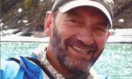
In memory of Kevin Whiting
Kevin Whiting was always intrigued by the potential for whitewater exploration in the Yukon. In January 2014, he emailed a group of us with his latest idea: to explore the O’Connor river.
The O’Connor starts at Samuel Glacier in the Haines Pass and drains into the Tatshenshini, which in turn meets with the Alsek. The trip was to be a first decent. Kevin was pretty confident about our ability to make it down. Being an engineer, he had studied the river like it was his job. Kevin had figured out the average gradient of each kilometer and recorded the data on an excel spreadsheet. He had also compared the O’Connor to other whitewater runs and figured out that it was similar in gradient. He emailed all this information to us along with two pictures taken by Lance Goodwin in a bush plane while flying over the area. The trip seemed convincing enough and within a few weeks, a crew of us committed to going. The culprits: Kevin Whiting, Dan Whiting, Dustin Shewfelt, Lawrence Brennan, Jason Zrum, Geoff Dunbrack and myself.
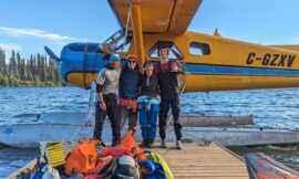
The trip plan looked like this: We’d begin with a 14 km hike to Samuel Glacier – the headwaters of the O’Connor. From there we’d kayak for three days before reaching the Tatshenshini and Alsek. According to the topo maps, we’d expect a challenging canyon midway through and continuous but less committing whitewater in between. Eventually meeting the famous Tatshenshini and Alsek, we’d have a relaxing three-day paddle through braided channels, glaciers and icebergs. We’d finally end up in Dry Bay Alaska where a bush plane would pick us up and take us home.
On a beautiful sunny day in June 2014, we began hiking to Samuel Glacier with fully loaded kayaks on our shoulders. Friends Vern and Mary Jane joined us for the hike. The boats were packed with seven days worth of gear, weighing over 100 pounds. We carried them on our backs with makeshift backpacks and slugged our way down the trail. It was grueling effort but we pushed on. By suppertime, we reached the edge of the river and realized it was going to be a challenge to descend. Below us, there was a 600-foot slope with no easy route down. The terrain was extremely steep. We made a plan and got to work. The ordeal took three hours. We used four throw bags tied together to lower the boats over the steep section of bank. We reached camp at the foot of Samuel Glacier around 9:30 pm, exhausted from the day but still excited to get on with our trip.
The next morning after breakfast, we went for a hike and scouted a box canyon that was located at the foot of the glacier, immediately below our campsite. At the rim of the canyon, we looked down and confirmed that the rapids were runnable. Up high, we found a beautiful green plain with lots of sheep hair and droppings. On the way back to camp, we sighted a wolverine running along the river bank. After packing our boats, we put on and entered the canyon. The water was excruciatingly cold coming out of the glacier. The canyon walls were impressive. The vertical grey cliffs were narrower at the top and wider at river level, making it seem like we were in a tunnel. I looked back and noticed Dan Whiting struggling in his boat. We paddled to shore and discovered a twelve-inch-long crack under the hull of his kayak. It was devastating to see this kind of damage so early in the trip. With limited wood in the alpine, we struggled to start a fire, dried the kayak and attempted to weld it. Luckily, Kevin had brought extra plastic and a torch. We worked as a team and two hours later were back on the water.
As we continued downstream, the landscapes widened and the scenery was stunning. It felt good to be in such a remote place. The river became larger as it picked up tributaries. Soon we were riding down continuous class 3-4 braided channels. We pulled over for lunch and I emptied my boat, realizing it was full of water. I found a crack under the seat. Two broken boats in one morning! The combination of cold water and shallow rocky riverbed was taking its toll. This time, we used Lawrence’s camp stove to weld the boat, all the while drinking cowboy coffee by the fire. I cut off some plastic from my cockpit rim using the saw on my Swiss army knife and used it as a patch to weld and seal the hull.
We put back on the river and paddled for an hour until the rapids became larger and larger. We pulled over and looked at the aerial pictures and realized we were entering the crux canyon.
Unsure about the rapids, we setup camp and went for an evening scouting mission. A quick walk downstream determined that travelling at river level was not an option. Therefore, we hiked to the top of the rim. The canyon walls were massive! Once up high, we traveled through the thickest brush I have ever seen! It took us three hours to travel three kilometers. We headed to the edge to take a look at the rapids. Downstream was a series of significant class 5 drops. The river looked high and there were limited eddies. It looked big from 600 feet up and I could only imagine how huge it would be at river level. I became nervous.
We continued bushwhacking through thick Alder to continue scouting. While holding onto a branch and peaking over the edge, we noticed a huge set of drops. There was a blind corner, with no eddies. It was impossible to portage at river level. The corner was followed by two river wide holes and a river wide sieve. The canyon was completely boxed in. Swimming in there would be deadly and loosing a kayak would certainly be a nightmare. We decided to head back to camp and have a discussion about what we saw over supper. After three more hours of bushwhacking, we arrived back at camp for midnight. We lit a fire, cooked some food and made a game plan.
As we discussed, it was clear to everyone that running the canyon was not an option. The river was too high due to recent snowmelt and rain. Portaging this section was the only option. We knew it would be the hardest portage any of us have ever done. We went to bed planning for an early 6am wake up. I had a hard time sleeping, with such a daunting task ahead of me.
Jason Zrum woke us up at 6am. The skies were dark and rain was underway. After some oatmeal, we set off at 8am. The first step was to leapfrog our boats to the top of the rim using a small creek bed as our route. Taking short trips back and forth, we reached the top after an hour. From there, we began the most heinous bush whack anyone has ever seen.
Towing our boats behind our backs, we progressed through the thick brush in the pouring rain. We were soaked to the bones. The terrain never let up. There were no clearings. Deep valleys and creek beds got in our way, where the forest was even more lush and mosquitoes eat us alive.
The halfway point of the portage was a giant valley Dustin Shewfelt named “big ass creek.” It was not a route back down to the O’Connor but instead a huge obstacle in the middle of the portage. In order to get across the valley, we lowered our boats down incredibly steep terrain, holding onto willows for dear life. At the bottom, we lit a fire to warm up and eat some lunch. Lawrence flipped open his rain jacket and rolled himself a joint on the goretex fabric. Times were tough.
After lunch, we ascended the other side of “big ass creek.” This was the crux of the portage and it took three hours to travel 300m. We had to leapfrog our boats and gear up the valley. False summit after false summit, the top of the valley took forever to reach.
However, the portage was far from over. We kept bushwhacking for many more hours towards a possible decent route Dustin marked on his GPS with a question mark. At one point, the forest slightly let up and we traveled 700m in one hour. Our spirits picked up during that time.
We finally reached a gully that we used to descend back to the O’Connor, arriving at 9:30pm. The portage took 13 hours. It was horrendous. However, we completed it and no one complained. I was grateful to have such a strong peer by my side. With nowhere to camp, we put on the river and paddled some large class 4 rapids, although extremely exhausted. We finally found a nice bench to camp. I felt glad no one got hurt that day.
The following morning, we woke up late, around 9am. We spent a relaxing couple of hours drying our gear and getting re-organized. Around 1pm we got on the water and paddled the rest of the O’Connor. There were some fun rapids and a few good boofs. The river finally opened up into wide braids until we reached the Tatshenshini. Having guided many Tat trips, I felt at home.
We paddled to the Towagh Creek campsite and also to pick up an important drybag full of wine that Natalie Sands had stashed for us while guiding a week prior.
The rest of our trip was an enjoyable and stress-free paddle down the Tat/Alsek with good weather and good friends. Our booze didn’t last long as we may have enjoyed finishing a bag of wine while rafting our kayaks together and giggling our way down the braided channels. Luckily though, we helped a group at Alsek lake portage their rafts around a big ice jam. In return, they gave us more wine, smoked salmon and cheese.
The lake was completely plugged with icebergs that year due to an earthquake. There wasn’t an inch of water to paddle on Alsek lake.
That night we hiked up the knob to soak in the view. The ice was an impressive sight!
On our last day, we paddled to dry bay Alaska in time for our flight. As I reflected, the trip was a great experience and a successful first decent. However, I now realize why people put in for the Tatshenshini at Dalton post and not at Samuel Glacier! The O’Connor crux canyon is still waiting to be run. Thank you, Kevin Whiting, for organizing this expedition. Rest in peace my friend.


